For several years various friends and acquaintances had told us about the marvelous things they had done and seen in Namibia. Having been shown a particularly impressive set of photos earlier this year, we decided that it was time for us, too, to make the journey. We finally went for a fortnight in the middle of September, which is near the end of Namibia's dry season and also represents roughly the beginning of spring.
This piece is the first of three. It covers the trip from Windhoek, Namibia's capital, to Walvis Bay on the coast. Part 2 will deal with the onward journey north, initially along the coastline and then through the interior of the country to the town of Outjo. The third and final installment will consist mainly of wildlife photos taken at the Etosha national park.
We booked what was billed by the tour operator as a self-drive safari and followed a fairly 'standard' itinerary, taking in several of Namibia's key sights. When we decided on the precise route and explored the accommodation possibilities, we had – to be honest – not given a great deal of thought to the distances involved. Namibia is a vast country. When we returned our hire car at the airport we found that we had driven over 3900km.
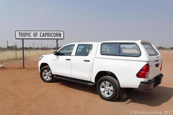
Our vehicle is shown in the photo at the top of this article – a Toyota Hilux 4x4. We were very impressed with it. It was ideal for the driving conditions we encountered and it is very well engineered. (Despite that, we ended up with a cracked windscreen – more about that later.)
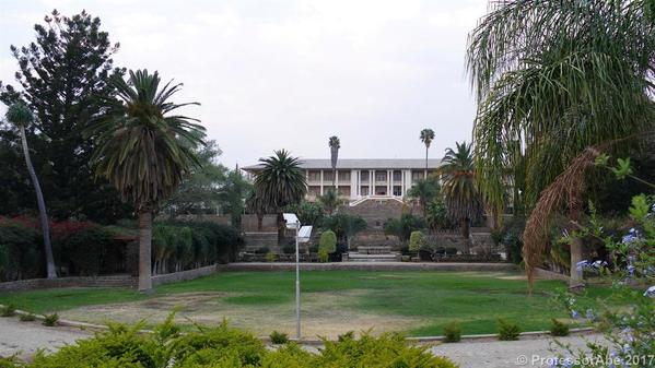
We flew from London to Windhoek via Doha, which is certainly not the most direct route. However, the alternatives were either ridiculously expensive or involved very poor connections. As we arrived around lunchtime, we did not have a great deal of time to look around Windhoek – but we soon discovered that there is not really a great deal to see either. The photos below show two of the main sights, the parliament and the Christuskirche ('Christ's church'), respectively.
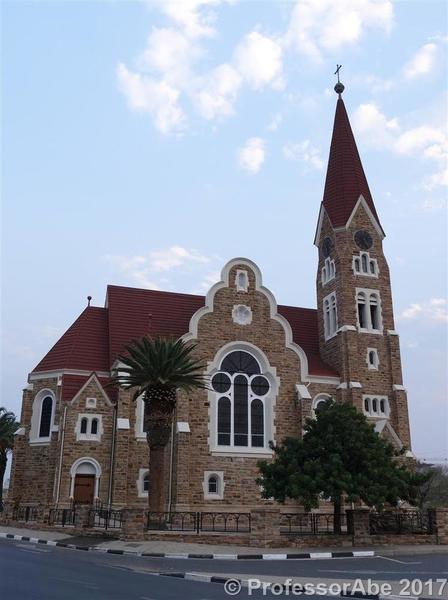
If the church's German name puzzles you: between 1884 and 1915 Namibia was a German colony, known as Deutsch-Südwestafrika ('German South-West Africa'). Even today the vast majority of visitors to the country are Germans and remnants of the colonial architecture and culture can be found in various places.
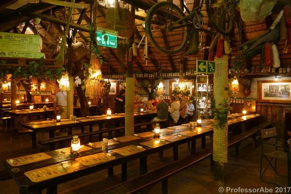
Having had coffee and cake at the Heinitzburg Hotel – which sits on a hillside providing good views over much of Windhoek – and looked round the town centre for an hour or so, we decamped to Joe's Beer House, a quirky pub/restaurant which our guidebook had recommended as a quintessential experience for any visitor to the capital. We absolutely loved it.
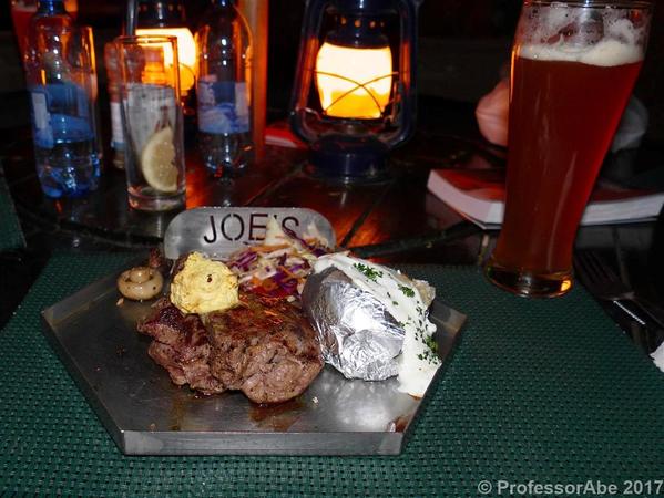
They brew a variety of different beers and we particularly enjoyed the slightly cloudy pale ale. It was also my first experience of Oryx steak – delicious! (By the end of the trip we had sampled meat from various kinds of antelopes, such as Kudu, Eland, and Springbok. Namibian cuisine is fairly meat-centric and the quality of the meat tends to be very good indeed.)
The next morning we set off south in the direction of the small town of Mariental. After just over an hour we crossed the Tropic of Capricorn, a photo opportunity.
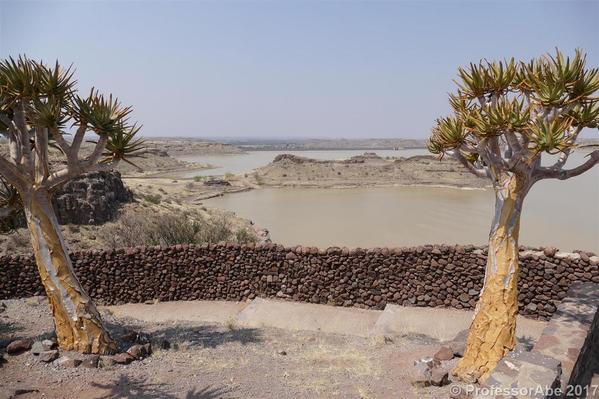
We reached the Mariental area around lunchtime and decided to visit the nearby Hardap reservoir, where we expected to see flocks of waterbirds. There were a few pelicans there, but disappointingly little else in terms of birds. It clearly was the wrong time of year.
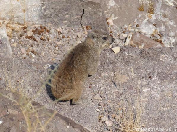
We did, however, catch our first glimpse of rock 'dassies', less colloquially known as rock hyraxes. They look a little bit like a cross between a rabbit and a koala bear, but apparently they are distant (!) relatives of elephants.
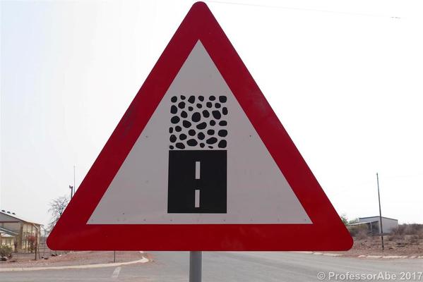
Our destination for the day was a safari lodge near the edge of the NamibRand nature reserve and from Hardap the route took us west to Maltahöhe, where we encountered the road sign below.
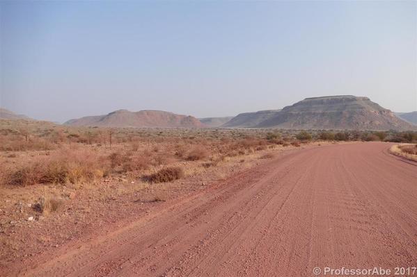
It indicates the end of the asphalt and the start of the gravel road, by far the most common type of road in Namibia. They tend to be quite wide – which is just as well, because often it feels like driving on snow. People have jokingly referred to the experience of driving on these roads as an 'African massage', because particularly at low speeds the transverse ridges in the surface can shake you to the bone.
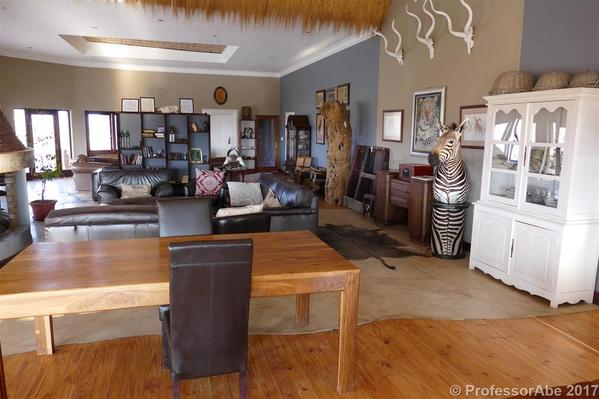
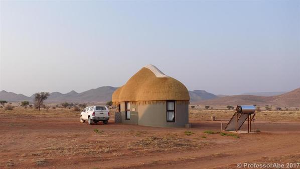
We reached the lodge just over an hour before sunset and were pleasantly surprised by the facilities and the comfort it provided.
This was a great relief because we had booked it ourselves, the tour operator having failed to find anything suitable in this area.
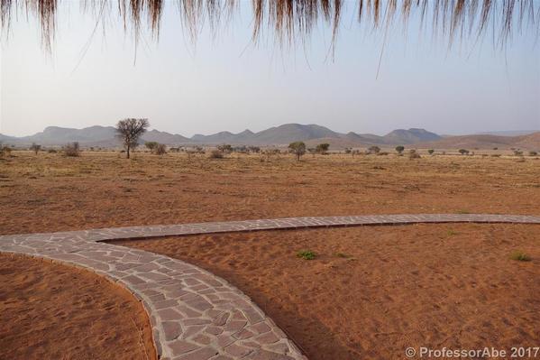
Below is a view from our front porch.
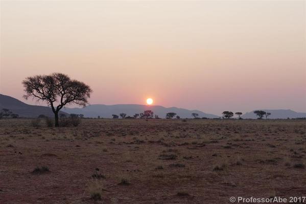
We loved the isolated location and the feeling of endless space around us. Watching the sun going down over the hills in the distance rounded off the experience.
We had wanted to stay here partly because the NamibRand reserve is a designated Dark-Sky reserve and we had high hopes of seeing spectacular night skies. In the event the slight haze (visible in the sunset photo) prevented the star gazing from being outstanding, but it was pretty good nevertheless.
The next morning we set off for Sossusvlei, an area of high dunes in the Namib-Naukluft national park. Within the Sossusvlei area we specifically wanted to visit the so-called Deadvlei ('Dead Marsh') of which we had seen a number of very impressive photos.
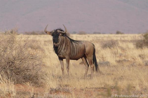
As we drove towards the lodge's gates we were treated to our first sighting of wildebeests.
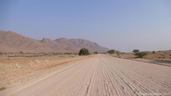
For much of the day we drove on gravel roads, some better than others. The stretch in the photo below was a relatively good one with very little corrugation.
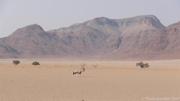
It was not long before we spotted our first oryx – there were many more later on.
The scenery along the road more than compensated for the uncomfortable driving experience.
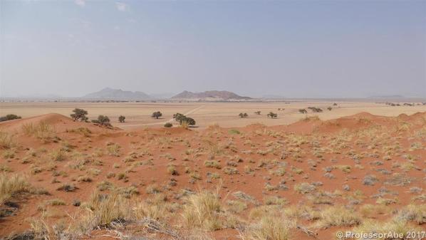
The closer we got to Sossusvlei, the more spectacular the landscape became. The next photo was taken just inside the national park and shows the red sand that is characteristic of much of the area.
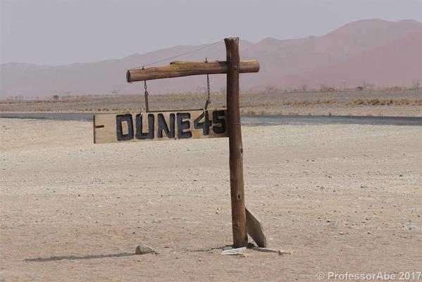
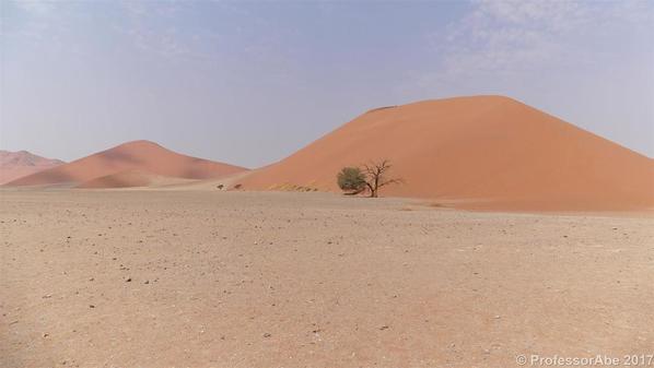
The high dunes offer good views of the surrounding area. Dune 45 – so named because it is located some 45km into the park – is a particularly popular spot for dune climbing.
The drive through the park towards Deadvlei was a very welcome relief, as the road had only just been freshly tarred. At the end of the asphalt road is a car park where most visitors leave their vehicles. The actual Deadvlei car park is a further 5km from here, but the route takes you through some pretty deep sand. I delude myself that we could probably have got through. However, in the event we chickened out – especially since we could see some other 4x4s stuck in the sand – and took the shuttle which the park authorities provide (for a fee).
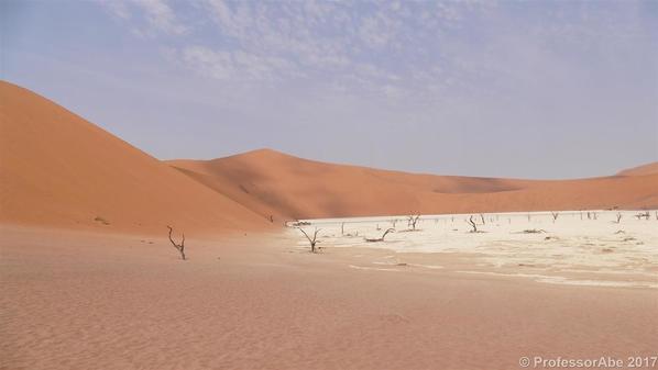
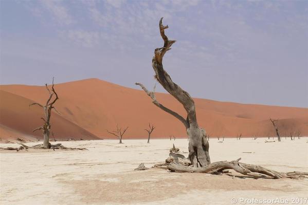
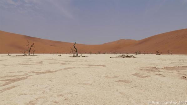
Getting to Deadvlei itself requires a 20 minute trek through the sand. We got there at around 13:00 and the car's thermometer had already shown 35 degrees centigrade when we left it. However, the humidity was very low and the walk was not really too demanding. In any case, the surreal scenery was well worth all the effort of getting here.
The trees in the photos are dead and have been so for a very long time. The white stuff on the ground is dried clay, left over from times when there was a regularly reappearing pool of water here which allowed the trees to grow. When the desert climate got the upper hand, the trees died. However, because of the extremely low humidity they have not rotted.
I could not resist taking umpteen photos here – you might be relieved that I am only showing you three!
As we were driving back to the lodge we discovered that there was a small crack at the bottom of the windscreen. I have no idea how it came about, but I suspect that a stone had hit the windscreen, either earlier in the day or at some point in the past, and that the severe vibrations from driving on the gravel surface caused the glass to crack. The crack traveled a bit further as we went along and also again overnight, but thankfully it stopped eventually. Upon checking our insurance documents we were relieved to find that we were covered.
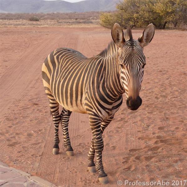
The next day's drive was another long one – some 6 hours driving time – and would take us down to the coast. As we went to breakfast we met the lodge's two semi-tame zebras, one of which is pictured below.
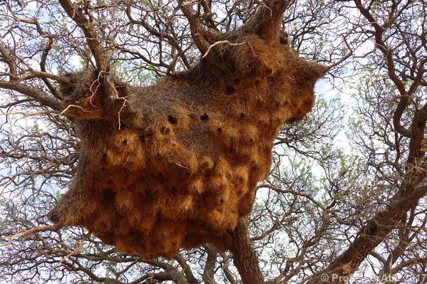
We also took the time to have a detailed look at the huge weaver birds' nest in the tree just opposite the restaurant building.
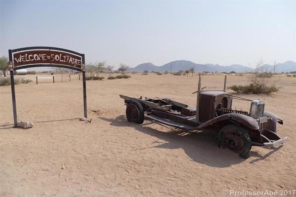
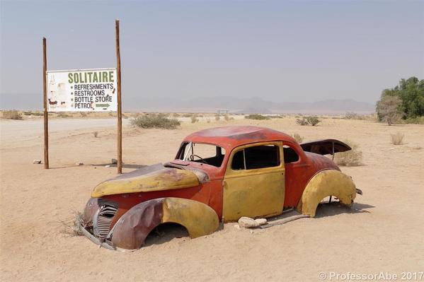
It took us just under two hours to reach the small settlement of Solitaire, where we stopped for fuel and a rest. In fact there are no other settlements (or petrol stations) on this route at all.
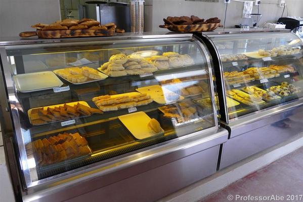
There is a bakery here and it has developed a reputation well beyond the local area, and indeed beyond Namibia. Many guidebooks refer to it and recommend its apple strudel in particular. We opted for a blueberry version, which we enjoyed very much.
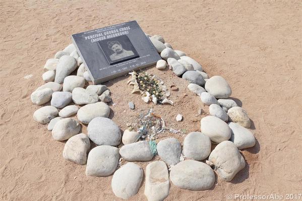
Sadly, the person who put the bakery, and Solitaire, on the map died some 3 years ago. Moose McGregor's memorial is just a few yards from the bakery's entrance.
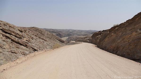
The onward journey took us through some interesting mountainous scenery before the road descended into the flat monotonous desert to the east of Walvis Bay.
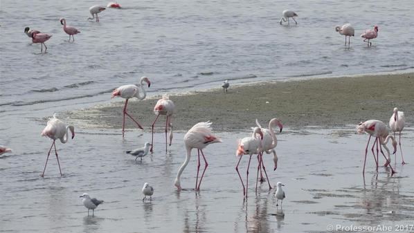
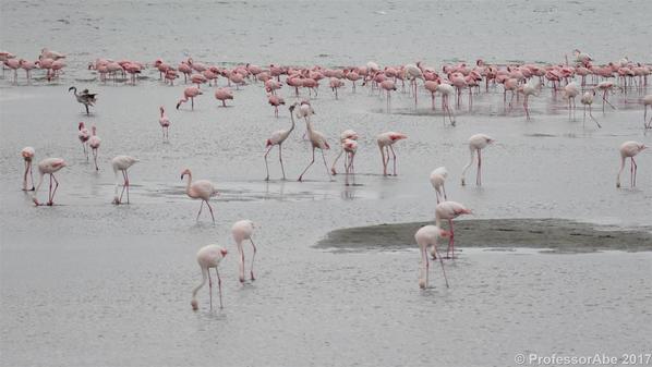
We reached the city, Namibia's second largest, around mid-afternoon and had enough time to take photos of the huge flocks of flamingos in the lagoon.
What the photos cannot convey is the dramatic drop in temperature between the interior and the coast: for most of the journey our thermometer had shown between 30 and 35 degrees centigrade, but here in Walvis Bay it was only 17 degrees and within an hour or two it had gone down to 13. This cool climate is the result of the Benguela current which flows northwards from South Africa and drives cold water along Namibia's coast. It also generates a virtually permanent cloud bank which moves inland in the late afternoon and only retreats mid-morning the next day, if at all.
When we reached our hotel, our first move was to set the air-conditioning in the room to 'heat mode'. The hotel actually was in Swakopmund, a short drive away from Walvis Bay. Part 2 will cover this town and the next leg of the journey.




Comments (2)