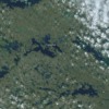
Time for a brief break in the ongoing cycle of news for an event that's now a few years old but escaped nearly everyone's attention: the satellite-photo discovery of the world's largest (so far as is known) third-order island.
If you look closely you can see it on the NASA high-def satellite image above.
Located on Victoria Island, Canada, itself the world's eighth-largest island, the unnamed and likely unexplored 'third-order' island is in a lake that is on an island that is in a lake that is on Victoria Island. Let that sink in a moment!
It was first documented in 2007 by Josh Calder, who was studying images of Victoria, which is split between Canada's Northwest Territories and Nunavut. The nearest known humans live in Cambridge Bay, 90 miles away and with no roads to the area. It's possible that similar discoveries will eventually strip the island of its title as largest; much of the area is unexplored.
And for the geography trivia fans, Canada is the only country that includes three of the world's ten largest islands (Baffin, Victoria and Ellesmere). Indonesia has two (Borneo and Sumatra) and part of a third (New Guinea). The others are scattered about, including Greenland, Honshu, Great Britain (#9 on the list) and Madagascar. You can find details on Britannica.


Comments (0)