Portland Bill Revisited: Pictures from a small island


Begging indulgence from the Senior Gumbo Gurus. Following my previous visit to stormy Portland Bill last week, yesterday the sun came out and the wind picked up a notch more, so I just had to make a quick trip back there to see what might have changed.

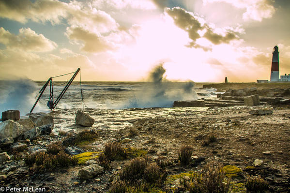
Viewed from behind Portland Bill's 145 foot high lighthouse, towards the Trinity House stone obelisk (the pre-lighthouse warning of rocks), it couldn't be a nicer day - except that the scene completely disguises the continuous stream of salt spray coating me and my camera lens... The wind had only moved round a couple of points to the west but the sea was behaving quite differently.

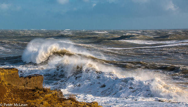
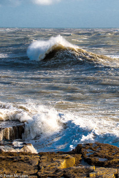
Hard to capture the impression of a 'big' sea in a photograph but this sea was producing some big breakers well offshore where there are no rocks.

untitled-6584

untitled-6562

Waves crashing onto the rocks below the lighthouse look quite surreal against a sunny sky.

untitled-6610

The old stone-loading crane must be the most sea-lashed item on this beach! It is continually drenched and often totally obscured beneath a crashing wave.

untitled-6641

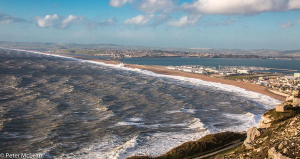
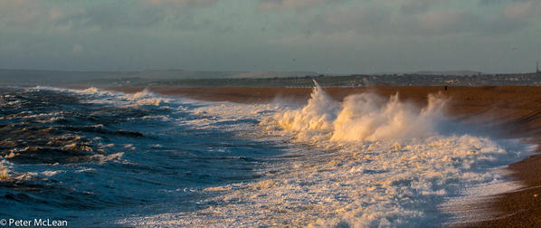
Round to the other side of Portland, to Chesil Beach, the naturally formed pebble beach linking Portland with the mainland and Weymouth beyond. The beach was attracting a good pounding but it contrasted the rough open sea with the sheltered waters of Portland harbour on the other side of Chesil.

untitled-6679

Down at beach level the rollers were pretty impressive.

untitled-6840

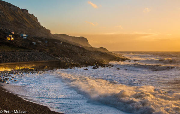
Below, is the top end of Chesil Beach right below Tout Quarry (500 feet high) where much of the beautiful Portland stone was quarried for London's S. Paul's Cathedral and the Houses of Parliament. The finest and most sought after Portland stone could only be reached by cutting through through an upper strata of low quality stone. The low quality 'spoil' from this upper strata of rock was simply discarded over the quarry's edge where it tumbled to the sea below. Quite a rock pile.

untitled-6856

Finaly a note to Dr. F - struggling to get the very best photos from close to the high edge of Tout Quarry, you will not be surprised to learn that the gusting winds plucked your plucky correspondent's cap from atop his head and sent it spinning like a small alien flying saucer into the brambles far below!! It was later recovered, but such are the lengths that one must go to for our esteemed readers (note to self: wear a beanie in future...)

Attachments

Images (8)
  • untitled-6562
  • untitled-6584
  • untitled-6610
  • untitled-6641
  • untitled-6665
  • untitled-6679
  • untitled-6840
  • untitled-6856

One’s destination is never a place, but a new way of seeing things."  Henry Miller

Add Comment

Comments (8)

Newest · Oldest · Popular

A little surprising not to find at least one surfer wanting to ride into that nice soft sandy beach, but maybe the waves don't "break" just right.   Have the British never seen the epic movie "Riding Giants" (about those surfers who ride the monstrous 10 meter waves)?  Nor a single wind-sailer out their either.

Twitter: @DrFumblefinger

"We do not take a trip, a trip takes us".  John Steinbeck, from Travels with Charlie

Having walked along Chesil Beach, to the NW of Portland, what you describe, DrF, as "nice soft sandy beach", is actually rocks.  I suspect those beaches in Mac's pictures are the same, not much fun to walk on and I'm guessing no fun to hit coming off a board.

PortMoresby is very right DrF, Chesil Beach is a 'shingle' beach is 29 kilometres (18 mi) long, 200 metres (660 ft) wide and 15 metres (50 ft) high - and pretty steep too!! The 'shingle' (large round pebbles) varies from pea-sized at the north-west end (by West Bay) to orange-sized at the south-east end (by Portland).


It is said that smugglers who landed on the beach in the middle of the night could judge "exactly where they were" by the size of the shingle. The beach has been the scene of many shipwrecks, and as such was named by Thomas Hardy as "Dead Man's Bay".


Portland Bill is been considered one of the English Channel's most dangerous hazards. Aside from the promontory jutting out into the channel, the 'Portland (tidal) Race' and Shambles sandbank make the conditions around the Bill even more hazardous. The Portland Race can run up to 10 knots in spring tidal streams, and are created when the tide and current clash round the Bill Point. Passing vessels are warned to stay between 3-8 miles offshore as they pass this point!(Thanks Wikipedia).


Not a beach to lay your towel on and dig your toes into the sand :-) Weymouth town's beach, by contrast has some of the finest sand of all English beaches - bring your deckchair here!


One’s destination is never a place, but a new way of seeing things."  Henry Miller

If its sun-sea-sand and safe surfing you're looking for then try Liverpool -in the North West of England.

Where the sand is so soft that even Rolls Royce use it to smooth car bodies prior to painting.

So you're guaranteed a smooth landing when your board comes ashore !


IMG_1271

Attachments

Images (1)
  • IMG_1271
Last edited by GarryRF
Post
×
×
×
×
Link copied to your clipboard.
×